All Dives Dive

Mew Island North

Copeland Islands

Average score: 0

Site name: Mew Island North
Location: Descriptive location referring to nearest landfall i.e. town, village, harbour or island
Copeland Islands
Type: Describes whether this dive site can be dived from the shore, from a boat, or both
Boat
Wreck: Dive sites which include a shipwreck (or part of a shipwreck) are labelled with a ‘Yes’
No
Min. dive depth (m): The approximate minimum depth of the dive given in metres
11
Max. dive depth (m): The approximate maximum depth of the dive given in metres
30

Max. seabed depth (m): The maximum depth of the seabed at the site taken from the intersect between the dive site point and the depth contour on an Admiralty Standard Nautical Chart
40

Diving experience (min level): The recommended minimum level of diving experience for a specific site, described as Novice (<50 dives in temperate/cold waters and minimum certification of PADI Open/Advanced Open Water, BSAC Ocean Diver or CMAS 1 star), Intermediate (50-100 dives in temperate/cold waters and minimum certification of PADI Rescue Dive, BSAC Sports Dive or CMAS 2 star) or Advanced (>250 dives in temperate/cold waters and minimum certification of PADI Divemaster, BSAC Dive Leader or CMAS 3 star
Advanced

Optimal wind direction: The general wind direction which causes minimal exposure at the site, corresponding to 8 points of the compass: North (N), North East (NE), East (E, South East (SE), South (S), South West (SW), West, North West (NW)
SW

Exposure: The approximate level of exposure to wind and wave action at the site on any given day, described as Sheltered (inshore sites surrounded by a form of shelter on all sides), Moderate (sites which are partially sheltered) or Exposed (sites with little to no shelter)
Exposed

Tidal strength: Anecdotal description of tidal strength at the site
Strong

Marine Protected Area: A Yes or No highlighting whether or not the site occurs within a Marine Protected Area
Yes

Visibility: Anecdotal description of the typical underwater visibility at the site
Typically 5-10m
Best time to dive: Anecdotal recommendation for the best time to dive the site for optimal underwater conditions. This typically relates to the stage of the tide
One hour before slack water.
Getting There: Directions for getting to the site

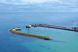
By boat from Donaghadee or Bangor.

Facilities: Details of nearest facilities to dive site i.e. public car parking and toilets, slipways etc

There are no facilities on the Copeland Islands.

Free parking is available near Donaghadee and Bangor Marina.

Nearest tank filling: DV Diving, Newtownards.

Hazards: Anecdotal information on possible hazards at the site for divers and snorkellers

Strong tidal currents, eddies and overfalls occur all around the Islands

Very Strong currents can pull divers far out into Belfast Lough.

An SMB should be deployed throughout the dive

Description: A general description of the physical features of the dive site

Kelp forest, dominated by rock seabed and gullies.

Steeply sloping bedrock wall, down to ~26 metre shelf to the North, dominated by a diversity of sponges and dead man’s fingers.

Shelf steeply drops off to 40m+

Biodiversity: A description of the species composition at the site. Species of interest are highlighted. Follow the links for more information about the species on the NBN Atlas Northern Ireland website

Kelp forest dominates the upper part of the gullies and boulders. Walls are are densely encrusted with animal turf, with dominant species including dead man’s fingers Alcyonium digitatum, Devonshire cup corals Caryophyllia smithii, white-striped anemones Actinothoe sphyrodeta and a diversity of sponges.

Puffins and Manx Shearwaters are a common sight on the surface, in Spring and Summer.

VIEW ALL SPECIES RECORDS FROM THIS SITE

A link to the dive site location on the NBN Atlas Northern Ireland website, showing all species records from within a 1km boundary of the site centroid. Any new species records from the site submitted to Seasearch, iRecord, CEDaR Online Recording or iNaturalist will appear here
Local Charters: A link to the website for the nearest Dive Centre to the site. A map of all dive centres is provided under ‘Go Diving’

DV Diving

Environmental and Historical Designations: A list of any environmental or historical designations attributed to the site, or overlapping it. Follow the link for more information

Copeland Islands ASSI

Copeland Islands SPA


More Information: Links to additional information found online for the dive site

Copeland Bird Observatory

Safety: Safety tips

  • In an emergency call 999 or 112 and ask for the coastguard.
  • Follow VHF radio Channel 16 (156.8 MHz), the international distress frequency. Send a distress alert followed by ‘MAYDAY, MAYDAY, MAYDAY’ and ‘This is [boat name]’.
  • Find nearest defibrillator (AED) here.
  • Ballycastle/Rathlin Harbour Office No. 028 207 68525 Mobile Number 07803 505084
  • When navigating within Ballycastle or Rathlin Harbour, use VHF Channel 80.
Latitude, Longitude: The approximate XY coordinates for the dive site in Decimel Degrees (DD). These can be converted to DMS or DDM by following the link below
54.699771, -5.512215
Save this site (0)
Please login to bookmark Close

Leave a Comment

Dived here recently? Then let other divers know about this site from your experience!

Leave a Reply

Your email address will not be published. Required fields are marked *

This site uses Akismet to reduce spam. Learn how your comment data is processed.

    Join our Mailing List